Traful and Lemu Cura viewpoints See map
Traful viewpoint
Travel round trip: 10 kilometers
Type: car, bicycle, horse or walk
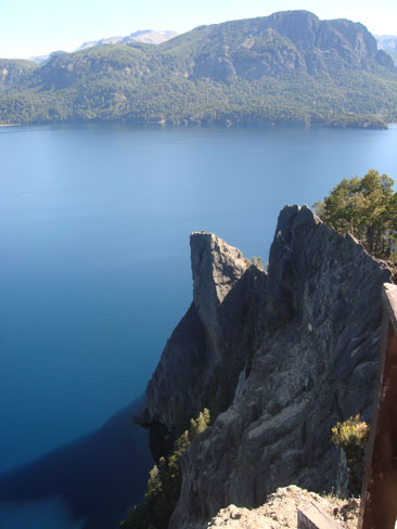
Leaving the village towards the Confluence Traful, and only 5 kilometers, is located this important vantage point. Walking is easily accessible by a footbridge built entirely of wood leading to two balconies sited on the crest of the rock formation, which directly overlook the lake Traful cliffs form a natural wall just over 100 meters high which causes the descent winds.
 View of Lake Traful from the lookout. Photo courtesy of Perez Pertino family.
This cliff marks the location of the head of the glacier that pierced the basin million years ago.
With the help of information and interpretation signage especially arranged on both balconies have access to important data on both landscape and geological environment that is displayed.
Lemu Cura viewpoint
Travel round trip: 6 kilometers
Type: Walking
Level of expertise: physical fitness is required
Special Recommendation: Bring water bottle.
After making 2 km along Provincial Route No. 65 toward Seven Lakes a cattle gurad is reached. Just cross it and on the left hand path that is mostly on the rise with an approximate length of 3 kilometers.
Going through a spectacular forest of cypresses, by overcoming the first rocks leads to a window with a beautiful view to the west of Lake Traful. By continuing to climb, the vegetation becomes a little more sparse and stunted, reaching a rocky crag is located at 1045 m with a view to the east. It noted the Village at the bottom and extending the lake and the Traful river valley to the Limay. Because of sun exposure and photographs is advised to go past noon.
Viajes por la Patagonia
Related Articles
© Patagonia.com.ar 2025 | Todos los derechos reservados.
